3D Laser Scanning.
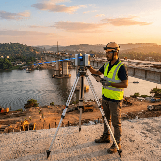
Spatial capture at millimeter precision. We deploy terrestrial LiDAR to digitize complex geometries across industrial, heritage, and infrastructure environments — from a single room to a full highway corridor.
The Technology Behind the Precision
Terrestrial LiDAR (Light Detection and Ranging) uses pulsed laser beams to measure distances and generate dense, three-dimensional point clouds with millimeter accuracy. Unlike traditional survey methods, LiDAR captures full spatial context — not just spot measurements — enabling downstream workflows like BIM modeling, deformation analysis, and facility management.
GESIX operates professional-grade instruments across a wide field of view, capable of capturing millions of measurement points per second. Registered scan sets are delivered as fully attributed, georeferenced point clouds anchored to your project coordinate system.
±2mm
Instrument Accuracy
360°
Field of View
1B+
Points Per Project
Deliverables
Applications Across Sectors
Bridge Deck Inspection
Detect spalling, geometric distortion, and deflection in concrete bridges without scaffolding.
Tunnel Profiling
Millimeter-accurate cross-section extraction across full tunnel lengths for lining analysis.
Industrial Plant Documentation
Capture complex process plant geometry for piping clash detection and equipment replacement.
Heritage Site Archival
Non-contact capture of fragile stonework, carved facades, and irregular masonry structures.
Highway As-Built
Full road corridor capture — carriageway, drain, embankment — in one survey mobilization.
Structural Deformation Monitoring
Repeat scan comparison tracks settlement and deformation across inspection intervals.
Our Scanning Process
Site Reconnaissance & Control Setup
Scanner Deployment & Station Layout
Multi-Station Registration
Point Cloud Processing & Classification
QA & Final Delivery
Technical FAQ
Ready to start your LiDAR scan?
Share your project scope — we'll respond within 24 hours.